|
|
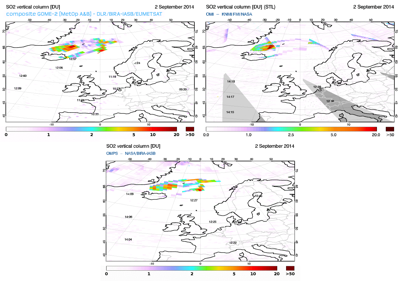
 The Ozone Mapping Profiler Suite (OMPS, see http://npp.gsfc.nasa.gov/omps.html) is a UV-visible (300-380 nm wavelength range) instrument on board the NASA Suomi-NPP platform. Launched in 2011, OMPS provides measurements with global coverage and nominal pixel size of 50 x 50 km. With a local equator overpass time at 1:30 PM, OMPS will extend the afternoon observations from the OMI instrument (launched in 2004).
Illustrations of the SO2 emitted by the on-going fissure eruption at Holuhraun (Bardarbunga system) and measured by GOME-2 (composite image MetOp A & B), OMI and OMPS on 2 September 2014.
The Support to Aviation Control Service is using the operational SO2 column and Absorbing Aerosol Index products of OMPS available at the NASA EOSDIS User Registration System. The SO2 column data set of OMPS is now part of the SACS notification system complementing the information already available from the other instruments (GOME-2A, GOME-2B, OMI, IASI-A,IASI-B, AIRS).
|