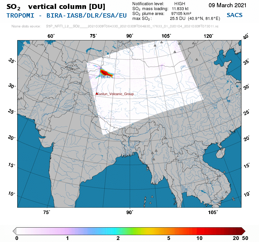
grey layout spacer                                                 NEAR REAL-TIME       NOTIFICATIONS       PRODUCTS      
print page
                                                            TROPOMI        region 209    

Date               :    2021/03/09
Time               :    06:47 UTC
Longitude          :    81.6 deg. East
Latitude           :    40.9 deg. North
Max. SO2 column    :     25.5 DU (assuming 15 km plume height)
SO2 mass loading   :   11.833 kt (assuming 15 km plume height)
SO2 plume area     :    97105 km2
Notification level :       HIGH
Volcano erupting   :    Etna
Cloud data         :    used for VCD
SZA                :     45.3 deg.
Name data source   : S5P_NRTI_L2__SO2____20210309T064330_20210309T064830_17633_01_020104_20210309T073011.nc


T
R
O
P
O
M
I
SO2 detection
TROPOMI - SO2 vertical column of 2021/03/09

Aerosols
TROPOMI - Absorbing Aerosols Index of 2021/03/09  

   
R
E
G
I
O
N
Volcanoes
REGION - Volcanoes close to the alert of 2021/03/09


Links to the near-real-time data pages
with maps from different instruments

NRT > 209 ==   90.0  30.0


Links to the list of volcanoes
in the nearest defined regions

volcanoes > 209 ==   90.0  30.0


Back

 
TEMIS Home Page  PROMOTE Home Page  O3M SAF Home Page Last update on 10 Mar 2021