|
|
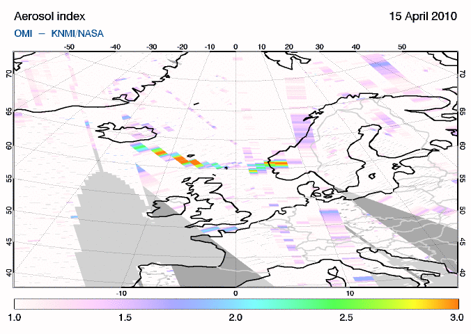
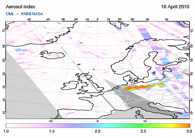
Ash smoke and sulphur dioxide (SO2) emitted by the volcano are monitored using satellite measurements as part of the SACS service*, jointly operated by BIRA-IASB, KNMI, ULB and DLR. Color maps presented on this page display absorbing aerosol index and SO2 columns observed with the OMI instrument.
The absorbing aerosol index is a qualitative indicator of the presence of ash particles in the atmosphere, which enables identifying the areas with the highest ash concentrations and to monitor the evolution of the volcanic cloud. * The Support to Aviation Control Service (SACS) hosted by BIRA-IASB aims at supporting the Volcanic Ash Advisory Centers, the official organizations responsible for gathering information on volcanic clouds. This is achieved by delivering near-real time data derived from satellite measurements regarding volcanic emissions, and in case of volcanic eruptions to send out alerts by email to interested parties. Useful links: - Support to Aviation for Volcanic Ash Avoidance (SAVAA) - Tropospheric Emission Monitoring Internet Service (TEMIS KNMI) - IASI results via the eumetsat special page (ULB) - Product Navigation SO2 (DLR) - London Volcanic Ash Advisory Centre (VAAC) - Global Monitoring for Environment and Security (GMES) |


