Eruption of the Merapi volcano
in Indonesia
November 2010
|

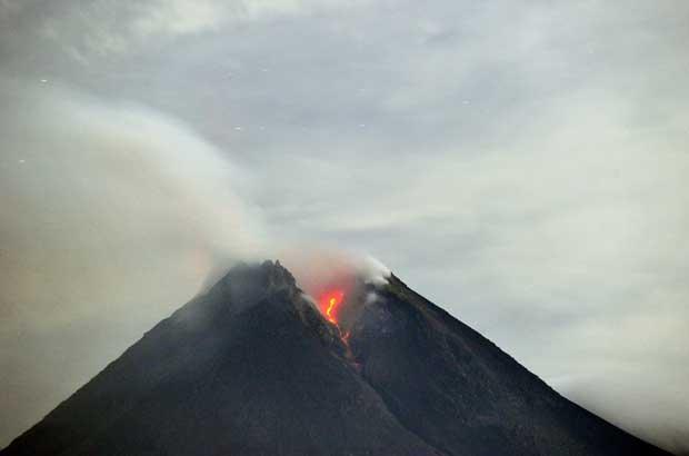
Plume of smoke
(the 29thOctober 2010)
(Credit: Adek Berry, AFP/Getty Images)
|
Mount Merapi, Gunung Merapi (literally "Mountain of Fire" in Indonesian/Javanese), is a conical volcano located on the border between Central Java and Yogyakarta, Indonesia (altitude 2968 m). It is the most active volcano in Indonesia and has erupted regularly since 1548. On 25 October 2010 the Indonesian government raised the alert for Mount Merapi to its highest level and warned villagers in threatened areas to move to safer ground. On the afternoon of 25 October 2010 Mount Merapi erupted lava from its southern and southeastern slopes. It is very close to the city of Yogyakarta, and thousands of people live on the flanks of the volcano, with villages as high as 1700 m above sea level.
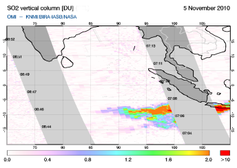
Ash smoke and sulphur dioxide (SO2) emitted by the volcano are monitored using satellite measurements as part of the SACS service*, jointly operated by BIRA-IASB, KNMI, ULB and DLR. Color maps presented on this page display Vertical Column Density (VCD) and Differences of Brightness Temperature (DBT) of SO2 observed by GOME-2, SCIAMACHY, OMI (UV-visible intruments), IASI and AIRS (infrared instruments).
Vertical column density and brightness temperature differences of SO2 observed by UV-visible and infrared intruments (the 5th of November 2010).
|
|
Animation of SO2 emission from OMI, GOME-2 and SCIAMACHY instruments (from 03/11/2010 to 18/11/2010).
|
 |
Indonesia's Mount Merapi has unleashed a violent eruption that more than doubled its earlier death toll, to more than 100 people. It has also forced evacuation camps to relocate, and the president has declared the situation a national disaster.
* The Support to Aviation Control Service (SACS) hosted by BIRA-IASB aims at supporting the Volcanic Ash Advisory Centers, the official organizations responsible for gathering information on volcanic clouds. This is achieved by delivering near-real time data derived from satellite measurements regarding volcanic emissions, and in case of volcanic eruptions to send out alerts by email to interested parties.
Useful links:
- IASI alert system ( ULB)
- GOME-2 alert system ( University of Bremen )
- Support to Aviation for Volcanic Ash Avoidance ( SAVAA)
- Product Navigation SO 2 ( DLR)
- Tropospheric Emission Monitoring
Internet Service ( TEMIS KNMI)
- Darwin Volcanic Ash Advisory Centre ( VAAC)
|


